Ballard
Old Scandinavian fishing town turned brewery district, with the locks and a giant troll.
Bus; light rail extension in progress
An intro to the city
Everything a first-time visitor needs before the rest of it makes sense — how the place is shaped, how to move through it, what closes early, and which of the things you have heard are actually true.
Pick one and you get a map and a shortlist. No account, no quiz.
You already know what you like
Nobody moves to a city wanting a city. You want the specific thing you used to do on a Thursday. Here is where that thing lives now.
The shape of the place
Seattle is a strip of hills wedged between two bodies of water. Get that in your head and the rest of the city snaps into place.
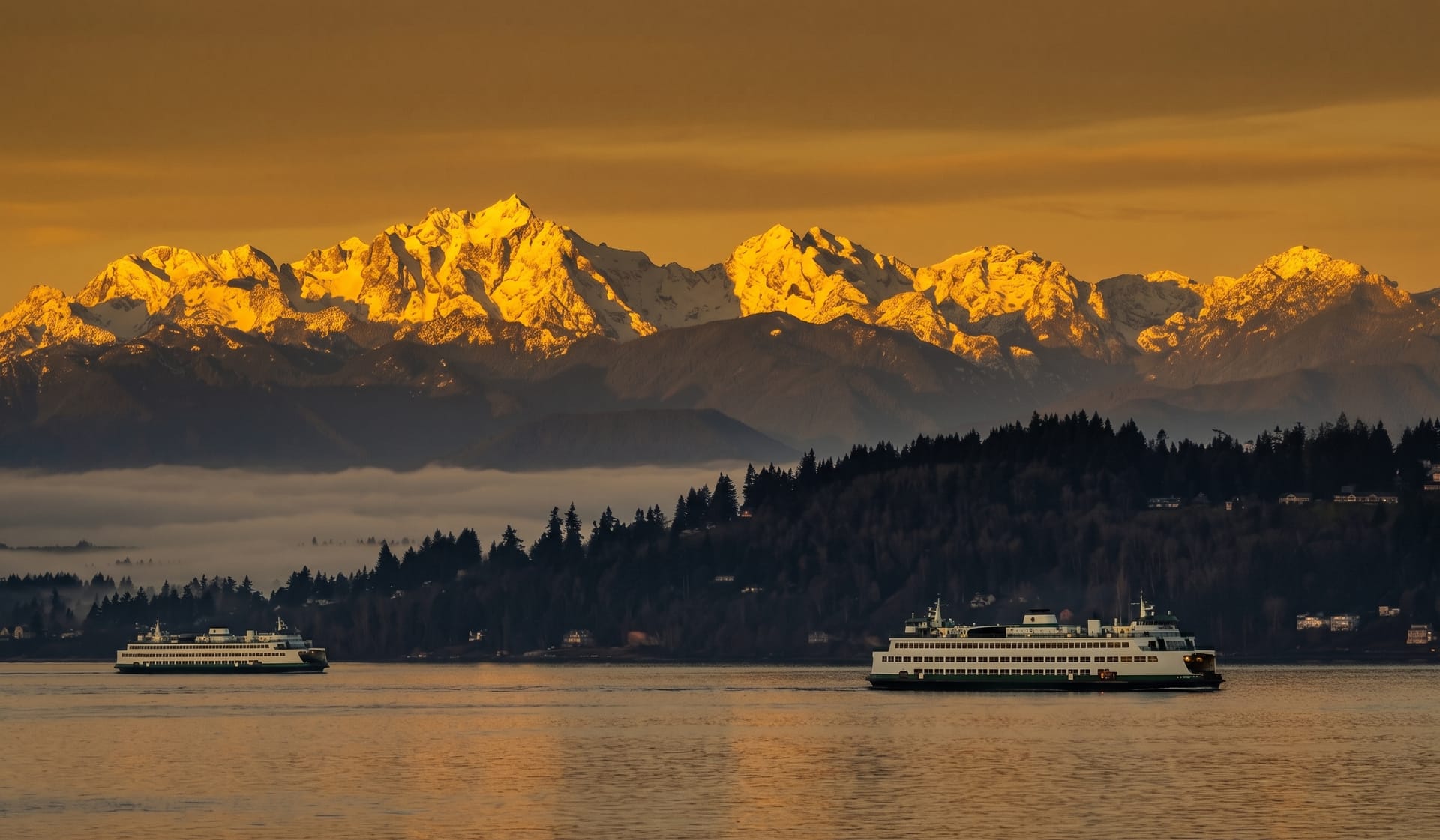
West is salt water. Elliott Bay, opening into Puget Sound, opening into the Pacific. This is the side with the ferries, the working waterfront, the sunsets. If you can see the Olympic Mountains, you are looking west.
East is fresh water. Lake Washington, twenty miles long, with Bellevue and the rest of the Eastside on the far shore. Two floating bridges cross it — I-90 to the south, SR-520 to the north. They float because the lake is too deep and too soft-bottomed to hold conventional piers.
In the middle is Lake Union, small and busy, ringed by houseboats and seaplanes and kayak rentals. It connects to both the other two through a canal and a set of locks, which is why you will occasionally watch a sailboat sail through the middle of a neighborhood.
South is Mount Rainier, and on a clear day it does not look real. It is 14,410 feet, roughly 60 miles away, and locals call it “the mountain.” When somebody says the mountain is out, they mean the clouds have cleared and you should go look right now.
I-5 runs north–south through the whole thing and is the spine of every direction anybody will ever give you. North of downtown, south of downtown — that is how the city is described.
It is hilly. Not San Francisco hilly, but enough that a route that looks like a ten-minute walk on a map can be a genuine climb. Queen Anne, Capitol Hill, Beacon Hill, First Hill, Magnolia — the names are not decorative. Check the elevation before you commit to walking somewhere, and know that downtown’s east–west streets go steeply uphill from the water.
The rest of the region
People say “Seattle” and mean a metro area of about four million people spread across water and hills. The other names you will hear:
Bellevue — directly east across Lake Washington, about 20 minutes without traffic. Glossier, newer, more corporate, better Chinese food than most of Seattle. Now connected by light rail.
Redmond — further east, past Bellevue. Microsoft’s home. Suburban, green, ends of light rail lines.
Kirkland — northeast, on the lake’s eastern shore. A walkable downtown with a waterfront, a good summer destination.
Bainbridge Island — 35 minutes west by ferry from downtown. The classic first-time-visitor move: ride over, walk the town, ride back at sunset. The ferry ride is the attraction as much as the island.
Vashon Island — south, reached by a different ferry. Rural, artsy, deliberately unpolished.
The rest of the islands — Whidbey, Camano, Orcas, San Juan, Lopez. The San Juans are a serious trip north, not a day trip, and worth it in summer.
Tacoma to the south, Everett to the north, both real cities in their own right.
Portland is under three hours by car and a different state.
Washington State Ferries is the largest ferry system in the United States and locals use it to commute. Walking on is cheap and needs no reservation. Driving on in summer means a wait, sometimes a long one, and some routes take reservations well in advance. Walk on unless you have a reason not to.
Transit, bikes, and the construction tax
One card, every agency — buses, light rail, streetcar, water taxi, ferries, the works. You can buy a physical card or add ORCA to your phone’s wallet. Do this before you do anything else.
The Transit GO Ticket app is the alternative if you want mobile tickets without the card.
This is a bus city first. The network is dense, the routes are frequent on the main corridors, and OneBusAway or Google Maps will both get you there. Real-time arrival information is good.
Check for reroutes before you leave. There is always construction somewhere, and it moves stops without much warning.
The 1 Line runs north–south through the city — Lynnwood down through the University District, downtown, the stadiums, the airport, and on south. The airport connection is the single best reason to know it exists: it goes straight downtown for the price of a bus ride.
The 2 Line serves the Eastside — Bellevue and Redmond — and as of March 2026 it crosses Lake Washington on the I-90 bridge, connecting the Eastside directly to downtown for the first time.
There is also a T Line in Tacoma, and two short streetcar lines in Seattle that are more novelty than transport.
The King County Water Taxi runs from downtown to West Seattle and Vashon. Fast, cheap, and a genuinely beautiful commute.
Washington State Ferries for Bainbridge, Bremerton, and the rest.
This is the part most visitors miss. Seattle is far more bikeable than its hills suggest, because the good routes follow old rail grades and waterfronts and stay flat:
Lime and other rentals are everywhere, and e-bikes make the hills a non-issue.
Possible, expensive, and mostly unnecessary in the city proper. Parking downtown and on Capitol Hill is genuinely painful. Rent a car for the day you go to the mountains, not for the week.
It is real, and it is beatable
Here is the thing everyone warns you about, and they are not wrong.
The Freeze is not unfriendliness. People will hold doors, give directions, apologize for things that are not their fault, and chat pleasantly with you in a line. What they will not do is turn that into a plan. “We should get coffee sometime” is a complete sentence here, not an opening move. Nobody is lying to you — they mean it warmly and they will not follow up.
A few things stack:
The move is recurrence, not intensity. One great conversation goes nowhere. Showing up to the same thing every Tuesday for two months turns strangers into friends almost automatically.
Newcomers who leave usually leave in year two. The ones who stay found their Tuesday thing.
The myth and the actual pattern
Seattle averages about 38 inches of rain a year. New York gets about 43. Boston gets about 44. Seattle does not crack the top 40 U.S. cities for annual rainfall.
It is grey about 200 days a year. The rain here is not storms — it is a fine, persistent drizzle spread across many months, the kind that never justifies an umbrella and soaks you anyway. Locals genuinely do not use umbrellas. A hood is the local technology.
Late June through September is the payoff. Long dry stretches, temperatures in the seventies, sunlight until after 9pm because Seattle is farther north than Toronto. This is one of the best summers of any city in America and it is the reason people put up with the rest.
October through May is the grey. Not cold — it rarely freezes and it rarely snows more than a few times a year — just dim. Sunset in December is around 4:20pm.
“June gloom” is a local term for the way early summer can stay overcast until the switch flips, usually right around the Fourth of July.
A rain shell with a hood, layers, and shoes you do not mind getting wet. Leave the umbrella. Bring sunglasses anyway — low winter sun through wet streets is blinding.
Things nobody tells you until you get them wrong
Seattle is a morning city. Kitchens close earlier than you expect, and plenty of local businesses shut at 2, 3, or 4pm — especially cafes and bakeries. Very few places are open past midnight.
Hours are also genuinely unpredictable: different on weekdays than weekends, different in summer than winter, and small places change them without updating anything. Check before you go, and check the actual business’s page, not just the search result.
Say this plainly: if you are coming here expecting a proper nightclub city, you will be disappointed. That is not what Seattle is.
What Seattle has instead is a good dive bar and speakeasy scene — small rooms, cocktails made by people who care, no line, no dress code. Lean into that and you will have a great night. Fight it and you will spend an expensive evening being underwhelmed.
Also worth knowing: drinks at clubs, concert venues, and stadiums are weak and expensive. Real bars pour honestly. Venues do not.
Black, grey, navy, dark green, and a technical jacket. That is the palette, year round, and it is barely an exaggeration. Fleece is formalwear.
If you dress nicely you will not be judged, exactly — you will be noticed, which is worse. Dressing down here is not laziness; it is the local code for not making it a thing.
About 10.55% sales tax in Seattle, one of the highest combined rates in the country, and it is not included in the price you see on the shelf. Budget for it.
There is also a sweetened beverage tax of 1.75 cents per ounce, which is why a bottle of soda costs noticeably more here than across the city line.
Eating out is expensive. Tipping expectations are high. A casual dinner for two adds up faster than you expect.
The actual reason this site exists
Yes, it started here. The Pike Place store is a photo, not a coffee. Seattle’s actual coffee culture is in the independent roasters and neighborhood cafes, and the gap in quality is not subtle. Any given neighborhood has two or three places better than anything with a logo you recognize.
Cafes double as the city’s living rooms — see the third places section — so picking a good one matters more here than in most cities.
Seattle’s best eating runs through its Chinese, Vietnamese, Japanese, Korean, Filipino, Thai, and Indian kitchens, and a lot of it is in unglamorous buildings on arterial roads. The Chinatown-International District, the stretch of Aurora, and the Eastside strip malls are all worth more of your time than most of downtown.
You will hear “teriyaki was invented in Seattle.” Not exactly — the technique is centuries old in Japan. What was invented here is Seattle-style teriyaki: charcoal-grilled chicken, a sweeter sauce, a scoop of white rice, a little cabbage salad, under ten dollars, in and out in fifteen minutes.
Toshihiro Kasahara opened Toshi’s Teriyaki on Roy Street in Lower Queen Anne on March 2, 1976, and the format spread across the city and then the country. At its peak Seattle had hundreds of teriyaki shops. Many are family-run and quietly disappearing, which is a good reason to eat at one.
Curated lists of specific spots are coming — this is the part of the site I actually care about.
Mountains, water, and three national parks
Mount Rainier, Olympic, and North Cascades are all within a few hours’ drive. Olympic alone contains a temperate rainforest, an alpine ridge, and a wild Pacific coastline — three completely different landscapes in one park.
Hiking is not a hobby here so much as a default weekend. Washington Trails Association (wta.org) is the community-maintained source everyone actually uses for trip reports and conditions. Check it before you drive anywhere.
Most trailheads need a parking pass — a Northwest Forest Pass, a Discover Pass, or a national parks pass depending on whose land it is. Get this right or get a ticket.
Mount Rainier, Mount Baker, Glacier Peak, Mount Adams, and Mount St. Helens are all active volcanoes in Washington. St. Helens erupted in 1980 and you can visit what is left.
Rainier is the one that matters: it is heavily glaciated, and the hazard is less the eruption than the lahar — a fast mudflow down the river valleys. Several towns south of Seattle have lahar sirens and evacuation routes posted. Seattle itself is not in the path.
If you are coming from a city with a river you used to sit next to, here are the equivalents:
Summer here is a water city. Boat rentals, paddleboards, and lake swimming are the best use of July and August, and most visitors never think of it.
Washington sits on the Cascadia Subduction Zone, which is capable of a magnitude 9 earthquake and a tsunami, and is overdue by geological standards. Locals live with this cheerfully. Worth knowing, not worth worrying about on a four-day trip.
What makes it this city and not another one
There is a tech industry here and it is enormous, but it is avoidable. Whole neighborhoods have nothing to do with it. The city underneath is an arts town — music, printmaking, glass, theater, small galleries, weird public sculpture — and that is the version most locals live in.
Grunge came from here, and so did Jimi Hendrix. The venues that mattered mostly still stand. Live music remains one of the genuinely strong parts of the nightlife, in a city where the rest of the nightlife is not.
Seattle is a place where Black Lives Matter organizing was early, visible, and sustained, and where street-level protest is a normal part of civic life. The politics are progressive, loud, and generally worn openly.
Danish artist Thomas Dambo built six giant trolls out of scrap wood across the region for Northwest Trolls: Way of the Bird King. They are free to visit and finding all of them is a genuinely good weekend:
Two of them need a ferry. Check current locations before you go — some are temporary installations and they do move.
There are somewhere around 150,000–180,000 dogs in Seattle and about 107,000 children. Dogs outnumbering kids has been true since the late 1990s. The city is enormously dog-friendly: patios, breweries, off-leash parks, shops with a water bowl and a treat jar by the door.
Bruce Lee and his son Brandon are buried at Lake View Cemetery on Capitol Hill, next to Volunteer Park. It is a quiet, well-visited grave and a short walk from one of the best views in the city.
Starbucks, Boeing, Amazon, Microsoft, Costco, Nordstrom, REI, Filson, Alaska Airlines — an unreasonable number of companies you have heard of started within an hour of here.
Seahawks (NFL) and Sounders FC (MLS) and Reign FC (NWSL) at Lumen Field. Kraken (NHL) and Storm (WNBA) at Climate Pledge Arena. Mariners (MLB) at T-Mobile Park.
Two things to know: Sounders supporters are among the loudest in the league and the march to the match is worth seeing, and the Storm are one of the most successful franchises in the WNBA. There is no NBA team, and that remains a sore subject.
Things to say at a bar
Where this is going
This page is the ramp-up — the stuff you need before anything else makes sense.
What comes next is the part I actually built this for: curated lists of places. Cafes worth the detour, restaurants that justify the prices, third places to sit for three hours, hikes by difficulty and season, and the water spots that make summer here worth it.
You will pick what you are into, and get a deck of places to swipe through.
Where to point yourself
Old Scandinavian fishing town turned brewery district, with the locks and a giant troll.
Bus; light rail extension in progress
The densest concentration of bars, restaurants and record stores in the city, and the heart of queer Seattle.
1 Line — Capitol Hill Station
The best concentrated eating in the city, and one of the few U.S. neighborhoods where Chinese, Japanese, Filipino and Vietnamese communities built side by side.
1 Line and 2 Line — International District/Chinatown Station
The most linguistically diverse part of the city, and where a lot of the best food is.
1 Line — Columbia City, Othello, Rainier Beach Stations
Where the famous things are — Pike Place, the Needle, the new waterfront park — and where locals mostly are not.
1 Line — Westlake, Symphony, Pioneer Square Stations
Self-declared "Center of the Universe" — a troll under a bridge, a rocket on a building, and a statue of Lenin.
Bus
Warehouses, artist studios, dive bars and breweries, with planes overhead.
Bus
A steep hill with the postcard view of the skyline, and the neighborhood that gave the city teriyaki.
Bus; steep walk from Seattle Center
Student prices, a very good street of cheap Asian food, and the prettiest campus in the city in April.
1 Line — U District and University of Washington Stations
Across the bay and slightly its own world — a real beach, the best skyline view, and a water taxi to get there.
King County Water Taxi from downtown; bus